 Dukes
Dukes
iPhone

Police
Reported police / speed trap (shield). Fresh reports may show a subtle pulse ring on the live map.
Reference
Pins and markers on the map in Dukes App on iPhone and CarPlay.
Crowd-sourced reports and database-style alerts on the main phone map. Colors match alert type (police shield, cameras, hazards, etc.).
iPhone
Reported police / speed trap (shield). Fresh reports may show a subtle pulse ring on the live map.
iPhone
Mobile or fixed speed enforcement styled as a gauge (distinct from the police shield used for some "speed trap" text reports).
iPhone

General hazard when no more specific subtype applies.
iPhone

Fixed speed camera (orange).
iPhone

Intersection red light camera (red).
iPhone

Automatic license plate reader camera (purple).
iPhone

Possible / suspected license plate reader (lighter purple).
iPhone
Fixed-wing aircraft on map when aircraft awareness or feed shows a plane; icon rotates with heading when data is available.
iPhone
Helicopter marker when reported or tracked.
iPhone

Crash or accident report.
iPhone

Heavy traffic / jam report.
iPhone

Closure or blocked road.
iPhone
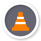
Roadwork or construction zone.
iPhone

Hazard subtype: ice on the roadway (light-blue circle with snowflake).
iPhone
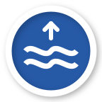
Hazard subtype: flooding (dark-blue circle with rising water waves).
iPhone

Hazard subtype: fog (gray circle with horizontal lines).
iPhone

Hazard subtype: heavy snow or unplowed conditions (blue-gray circle with cloud and snowflake dots).
iPhone

Hazard subtype: emergency vehicle on scene.
iPhone

Vehicle stopped on or beside the road.
iPhone

General weather-related hazard (rain, slippery road, etc.) when not a specific subtype.
iPhone

Debris, pothole, animal, or other object hazard.
iPhone

Standalone weather-type alert when not filed under hazard subtypes.
iPhone

Fallback pin when the alert type does not match a specific icon.
When a detector is connected and you are on a map that shows live signals (e.g. navigation), bands appear as Apple MapKit markers with band letters. Muted signals use a slash speaker glyph.
iPhone
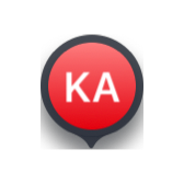
Ka band detection marker (red, "KA").
iPhone

K band (blue, "K").
iPhone

X band (yellow, "X").
iPhone

Laser alert marker (pink, "L").
iPhone

Muted signal: grey marker with speaker-slash icon.
Controlled by the location marker under App Settings → Map & Display.
iPhone

Optional directional arrow pointing in your direction of travel (north-up and heading-up aware).
iPhone

Standard blue dot with white ring when the arrow indicator is off (matches Apple Maps-style user location).
SwiftUI map pins: custom spots you add, and a representative lockout map marker.
iPhone

Pin for a user-added speed camera location.
iPhone

User-added red light camera.
iPhone

Combined speed + red light custom location.
iPhone

User-added license plate reader.
iPhone

User-added speed trap / enforcement spot.
iPhone
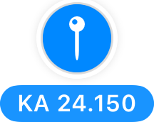
Representative lockout pin (band + frequency chip; color reflects band/state on the real map).
Feed and alert types on the CarPlay map use the same visual language as iPhone, sized for dash display.
CarPlay

Police / enforcement report.
CarPlay

Generic camera type when not split by database subtype.
CarPlay

Accident / crash.
CarPlay

Traffic jam.
CarPlay

Road closed.
CarPlay
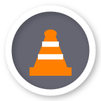
Construction / roadwork.
CarPlay

Generic hazard.
CarPlay

Stopped vehicle.
CarPlay

General weather-related alert (rain, slippery road).
CarPlay
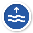
Flooding hazard (dark-blue with rising waves).
CarPlay

Fog hazard (gray with horizontal lines).
CarPlay

Ice on road (light-blue with snowflake).
CarPlay

Heavy snow or unplowed road (blue-gray with cloud and snowflakes).
CarPlay

Object or road debris.
CarPlay

Emergency vehicle hazard.
CarPlay

Fallback when type is unknown.
Smaller icons used for the community hazard layer on CarPlay so multiple hazards stay scannable.
CarPlay

Compact accident marker.
CarPlay

Compact stopped vehicle.
CarPlay

Compact general weather hazard.
CarPlay

Compact flood hazard.
CarPlay

Compact fog hazard.
CarPlay

Compact icy road hazard.
CarPlay

Compact snow / unplowed road.
CarPlay

Compact debris / pothole / roadkill.
CarPlay

Compact construction.
CarPlay

Compact emergency vehicle.
CarPlay

Generic hazard or broken traffic light.
Two sizes: small "nearby" icons on the map, and larger proximity pins when a camera alert is active. Colors match database type (speed, red light, ALPR, suspected ALPR, custom speed trap).
CarPlay

Small nearby speed camera.
CarPlay

Larger pin when alerting to this camera type.
CarPlay

Small red light camera on map.
CarPlay

Larger red light proximity pin.
CarPlay

Small ALPR on map.
CarPlay

Larger ALPR proximity pin.
CarPlay

Small suspected ALPR.
CarPlay

Larger suspected ALPR pin.
CarPlay

Small custom / speed trap style.
CarPlay
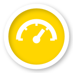
Larger speed trap proximity pin.
These are not pin icons. They still appear on the map when the related setting is on.
Map & Display
Historical enforcement heat along roads. This is a colored overlay, not a pin.
Road Alerts
Average-speed zone drawn along a stretch of road when corridor alerts are enabled.
Location Automations
Polygon border when Show geofence borders is on. Marks an automation area, not a report.
Navigation
Blue Apple Maps route line and destination pin while navigating. CarPlay can add heat casing around the route.
Alerts & Audio
Bearing cone or presence zone on the map when Radar Direction View is the banner style.
Map & Display
Apple Maps traffic coloring on roads when Traffic flow is on.
Road Alerts
Community jam lines drawn on the road in addition to jam pins.
Road Alerts
User-added spots use the custom camera, trap, or combined-camera pins above. There is no separate waypoint glyph.